Contact Info & Map
Principal: Dawn Uliana
Admin: Lisa Keenan
Media Contact
Members of the media are asked to direct all questions and requests to:
Ali Lupal
WCDSB Communications and Community Engagement Lead
Email: [email protected]
ST. PAUL CATHOLIC SCHOOL
September, 2010
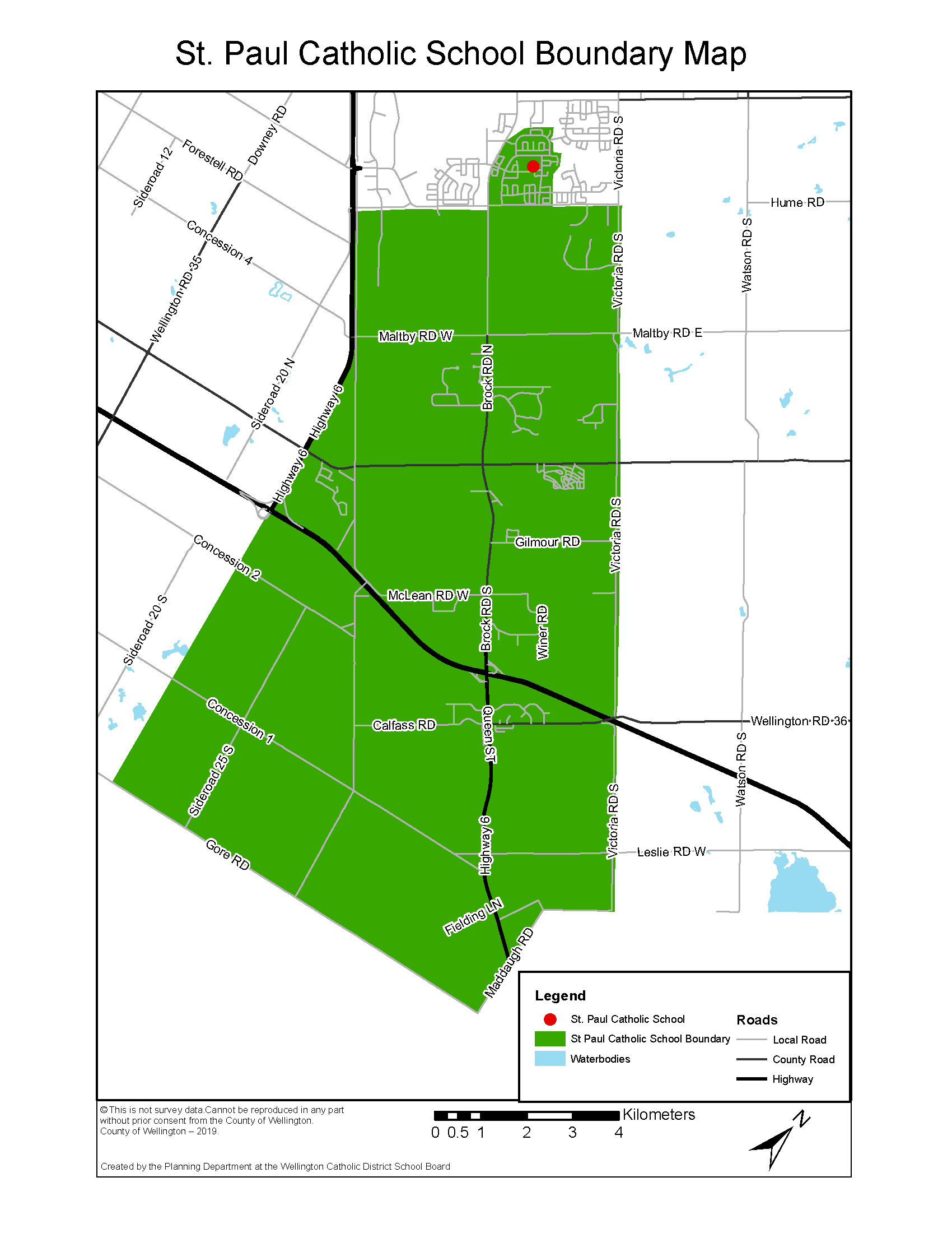
Area enclosed by:
Starting point: Victoria Rd. South (both sides) and Clair Rd. East
1. South on Victoria Rd. (both sides) to Flamborough-Puslinch Townline
2. West to Maddaugh Rd.
3. South to Gore Rd.
4. West to Hanlon Pkwy.
5. North to Clair Road
6. East on Clair Road to Gordon (only area south of Clair Road is within St. Paul boundary).
7. North on Gordon (East side only) to North of Lowes Rd.
8. East on Lowes Rd (both sides) to north of Pineridge Dr. encompassing Oakridge Cres. and Elderberry Court but not including Jensen Blvd.
9. Continue south along Pineridge Dr. (both sides) to encompass Farley Dr.
10. Continue south through green space parallel to Beaver Meadow Dr. to encompass McGarr Court & McArthur Drive to south of Clair Road East.
11. Continue East on Clair Rd. (neither side of Clair is within St. Paul Boundary) to East of Victoria Rd. South
Please Note:
1) Unless otherwise noted, the home school is the one on the same side of the street as the residence.
2) Boundaries are subject to change. Please verify with school or board office.